

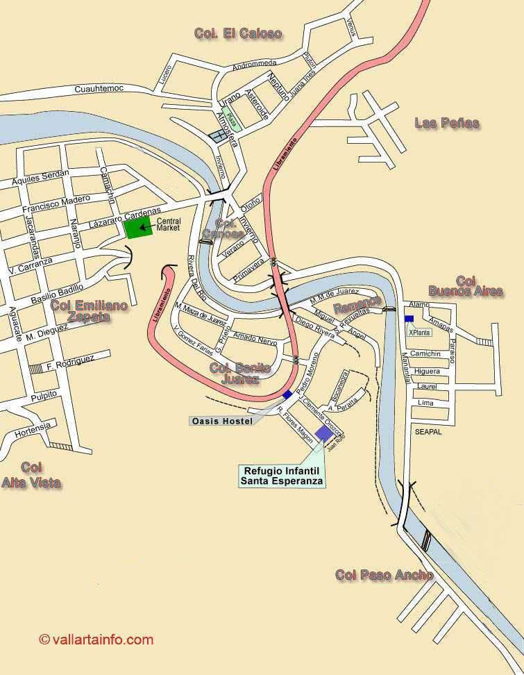
The Map Cuale Colonias shows the area east and south of Colonia Emiliano Zapata. ( the real name of the South Side, Old Town or Romantic Zone).
At the other side of the Rio Cuale over the bridge at the end of Calle Lá¡zaro Cá¡rdenas lies Colonia El Caloso on the left and Colonia Las Canoas on the right.
Onto the other side of the Libramiento (Bypass Road) Â is the Remance area, in Colonia Benito Juarez, and Colonia Buenos Aries where the road continues up the river to Paso Ancho.
MOVE TO SOUTHSIDE MAP
FURTHER UP THE RIO CUALE
The town of El Cuale, nestled high in the Sierra Madre mountains of Jalisco, Mexico, holds a fascinating history, particularly connected to the origins of Puerto Vallarta. Here’s a summary of its key historical points:
- Ancient Origins:
- It’s believed that El Cuale’s history predates the arrival of the Spanish, with evidence suggesting human habitation dating back centuries.
- There are indications that the area was part of the Aztatlán culture, which flourished in the region.
- Mining History:
- El Cuale is most notably known for its silver mining history.
- In the 19th century, mining operations, particularly those of the “Union en Cuale” company, played a significant role in the region’s development.
- These mining activities were a key factor in the growth of Las Peñas, which eventually became Puerto Vallarta.
- Connection to Puerto Vallarta:
- The mining operations in El Cuale were instrumental in the development of the coastal area that became Puerto Vallarta.
- The need for supplies and transportation for the mines spurred the growth of the port town.
- The town of El Cuale is where the Rio Cuale originates. Therefore it is the root source of the water that flows through Puerto Vallarta.
- Modern Day:
- Today, El Cuale remains a relatively remote town in the Sierra Madre.
- It offers a glimpse into the region’s past, with its historic church, San Antonio de Padua, being a notable landmark.
- The town is a location that is visited by people that wish to explore the more remote areas of the Sierra Madre mountains.
In essence, El Cuale’s history is deeply intertwined with the development of Puerto Vallarta, with its mining past laying the foundation for the coastal city’s growth.
Geographical Significance:
The Río Cuale flows from the Sierra Madre mountains down to the Pacific Ocean, dividing downtown Puerto Vallarta.
A notable feature is Isla Cuale, an island formed in 1926 after a hurricane altered the river’s course.